


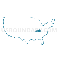
Buffalo Trace & Gateway Area Development Districts PUMA, Kentucky
About
Outline

Summary
| Unique Area Identifier | 192980 |
| Name | Buffalo Trace & Gateway Area Development Districts PUMA |
| State | Kentucky |
| Area (square miles) | 2,761.01 |
| Land Area (square miles) | 2,717.69 |
| Water Area (square miles) | 43.31 |
| % of Land Area | 98.43 |
| % of Water Area | 1.57 |
| Latitude of the Internal Point | 38.28949660 |
| Longtitude of the Internal Point | -83.61726550 |
Maps

Graphs
Select a template below for downloading or customizing gragh for Buffalo Trace & Gateway Area Development Districts PUMA, Kentucky


Neighbors
Neighoring Public Use Microdata Area (by Name) Neighboring Public Use Microdata Area on the Map
- Big Sandy Area Development District PUMA, KY
- Bluegrass Area Development District (Northeast) PUMA, KY
- Bluegrass Area Development District (Southeast) PUMA, KY
- Clermont (East) & Brown Counties PUMA, OH
- FIVCO Area Development District PUMA, KY
- Highland, Clinton & Adams Counties PUMA, OH
- Kentucky River Area Development District PUMA, KY
- Northern Kentucky Area Development District (Southeast) PUMA, KY
- Scioto & Lawrence Counties PUMA, OH
Top 10 Neighboring County (by Population) Neighboring County on the Map
- Clermont County, OH (197,363)
- Scioto County, OH (79,499)
- Brown County, OH (44,846)
- Greenup County, KY (36,910)
- Clark County, KY (35,613)
- Adams County, OH (28,550)
- Carter County, KY (27,720)
- Montgomery County, KY (26,499)
- Johnson County, KY (23,356)
- Rowan County, KY (23,333)
Top 10 Neighboring County Subdivision (by Population) Neighboring County Subdivision on the Map
- Winchester CCD, Clark County, KY (29,984)
- Mount Sterling CCD, Montgomery County, KY (18,780)
- Morehead CCD, Rowan County, KY (17,938)
- Maysville CCD, Mason County, KY (15,715)
- Cynthiana CCD, Harrison County, KY (13,456)
- Salyersville CCD, Magoffin County, KY (9,468)
- Jeffersonville CCD, Montgomery County, KY (7,719)
- Flemingsburg CCD, Fleming County, KY (7,484)
- Butler CCD, Pendleton County, KY (7,011)
- Stanton CCD, Powell County, KY (6,453)
Top 10 Neighboring Place (by Population) Neighboring Place on the Map
- Maysville city, KY (9,011)
- Mount Sterling city, KY (6,895)
- Morehead city, KY (6,845)
- West Liberty city, KY (3,435)
- Flemingsburg city, KY (2,658)
- Manchester village, OH (2,023)
- Ripley village, OH (1,750)
- Aberdeen village, OH (1,638)
- Owingsville city, KY (1,530)
- Vanceburg city, KY (1,518)
Top 10 Neighboring Unified School District (by Population) Neighboring Unified School District on the Map
- Clark County School District, KY (35,613)
- Carter County School District, KY (27,720)
- Montgomery County School District, KY (26,499)
- Rowan County School District, KY (23,333)
- Greenup County School District, KY (19,515)
- Johnson County School District, KY (19,495)
- Harrison County School District, KY (18,846)
- Mason County School District, KY (17,490)
- Lawrence County School District, KY (15,860)
- Pendleton County School District, KY (14,877)
Top 10 Neighboring State Legislative District Lower Chamber (by Population) Neighboring State Legislative District Lower Chamber on the Map
- State House District 88, OH (122,323)
- State House District 89, OH (120,820)
- State House District 74, KY (43,768)
- State House District 73, KY (43,459)
- State House District 96, KY (41,590)
- State House District 78, KY (41,569)
- State House District 99, KY (41,007)
- State House District 72, KY (40,906)
- State House District 70, KY (40,326)
- State House District 92, KY (40,191)
Top 10 Neighboring State Legislative District Upper Chamber (by Population) Neighboring State Legislative District Upper Chamber on the Map
- State Senate District 14, OH (380,921)
- State Senate District 28, KY (119,669)
- State Senate District 27, KY (110,935)
- State Senate District 18, KY (106,760)
- State Senate District 21, KY (105,934)
- State Senate District 24, KY (105,213)
- State Senate District 31, KY (101,309)
- State Senate District 25, KY (100,866)
Top 10 Neighboring 111th Congressional District (by Population) Neighboring 111th Congressional District on the Map
- Congressional District 6, KY (759,205)
- Congressional District 4, KY (741,464)
- Congressional District 2, OH (673,873)
- Congressional District 5, KY (670,051)
Top 10 Neighboring Census Tract (by Population) Neighboring Census Tract on the Map
- Census Tract 9502, Rowan County, KY (8,815)
- Census Tract 9202, Montgomery County, KY (7,257)
- Census Tract 9301, Pendleton County, KY (7,011)
- Census Tract 420, Clermont County, OH (6,466)
- Census Tract 9701, Powell County, KY (6,453)
- Census Tract 9702, Magoffin County, KY (6,381)
- Census Tract 9702, Bath County, KY (6,192)
- Census Tract 9702, Powell County, KY (6,160)
- Census Tract 9519, Brown County, OH (6,143)
- Census Tract 9203.02, Montgomery County, KY (5,767)
Top 10 Neighboring 5-Digit ZIP Code Tabulation Area (by Population) Neighboring 5-Digit ZIP Code Tabulation Area on the Map
- 40391, KY (35,262)
- 40353, KY (20,779)
- 40351, KY (20,329)
- 40361, KY (18,220)
- 41031, KY (15,886)
- 41143, KY (14,535)
- 41056, KY (14,228)
- 41164, KY (13,125)
- 41465, KY (11,979)
- 41472, KY (10,985)